

|
|
|
|
|
|

|
METAR s - TAF s Greece
|
|
|
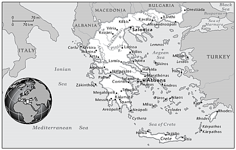
Location: Southern Europe, bordering the Aegean Sea, Ionian Sea, and the Mediterranean Sea, between Albania and Turkey.
Geographic coordinates: 39 00 N, 22 00 E
Terrain: mostly mountains with ranges extending into the sea as peninsulas or chains of islands.
Lowest point: Mediterranean Sea 0 m.
Highest point: Mount Olympus 2,917 m.
Climate: temperate; mild, wet winters; hot, dry summers. |
|
|||
| THE USER ACCEPTS SOLE RESPONSIBILITY AND ALL RISKS ASSOCIATED WITH USE OF THE METARs TAFs INFORMATION ON WWW.KIFISSIAMETEO.GR WEB SITE | |||
|
|
||||||||||||
|
|
|
||||||||||
|
| ||||||||||||
|
Web site Design and Development by: Giannis P. Fragos |
||||||||||||
|
|
||||||||||||